 Vista

Looking for an Indus Valley drainage system 3D model for a school project? This page uses one educational poster to explain simplified Harappan town planning, brick-built streets and drainage structures. Archaeological remains at cities such as Mohenjo-daro show organised roads and evidence of sanitation and drainage. However, a classroom model cannot prove that every Harappan city or every house had identical drainage arrangements. Students can build a lightweight cardboard display with labelled houses, street channels and drain covers. The original poster opens through Vista Hub’s existing 15-second advertisement-supported image page. A useful history project distinguishes excavated evidence from speculative decorative reconstructions, rather than treating an invented 3D view as a photograph of an ancient city.
What was the Indus Valley or Harappan civilisation?
The Indus or Harappan civilisation was an ancient urban culture of South Asia. Archaeological sites are spread across areas that now belong to modern India and Pakistan, with important settlements such as Harappa, Mohenjo-daro, Lothal and Dholavira. The Mature Harappan period belongs broadly to the third millennium BCE. Settlements varied in size, landscape, design and chronology, so they should not be reduced to one uniform city plan. A school model is a way of visualising selected evidence, not proof that all settlements operated exactly alike. Use cautious language when describing uncertain functions of excavated structures.
Picture: Indus Valley Drainage 3D Model
The visual poster shows a simplified group of houses, streets and drains. Brick-lined channels and covered drain sections are among the features reported from some excavated Harappan settlements. A student can point to a smaller house-side outlet, a street drain and a possible covered stretch to explain the principle. But the model does not establish the exact layout of a particular excavated street or house. Add the note ‘Simplified educational reconstruction — Not to Scale’. If the diagram includes invented modern pipes, clearly distinguish them from historically supported brick channels rather than claiming they were recovered in archaeology.
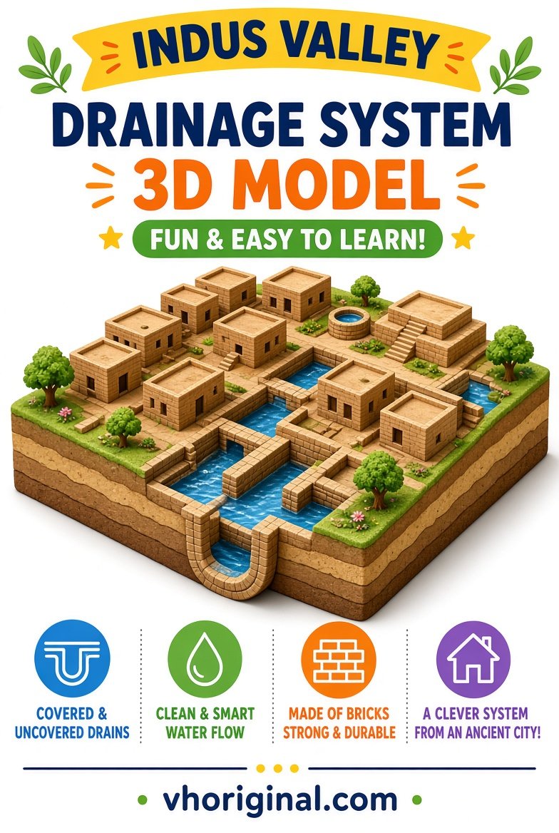
View / Download after 15-second wait
What does Mohenjo-daro reveal about town planning?
UNESCO’s World Heritage description of Mohenjo-daro discusses streets intersecting at right angles and urban planning that incorporated sanitation and drainage. These observations indicate notable attention to settlement layout in at least some important Harappan centres. The interpretation of any particular building or channel still depends on archaeological excavation and evidence. It would be misleading to call every structure a modern sewage-treatment plant or to assume that every home enjoyed the same facilities. Classroom captions should identify historical observations and avoid imaginary technical dimensions, such as a drain width that no source has verified.
Covered drains, street layouts and water flow
A possible school layout has a lane drain connecting toward a larger channel, with a removable card cover to illustrate protection or accessibility. A slight model slope can help explain why gravity matters to moving water, but it is not a measured gradient for any real Harappan drain. Modern water supply, wastewater management and drainage are not interchangeable concepts. Use different labels when they are shown. Excavations reveal physical structures; their precise purpose may require analysis of context and associated remains. Do not attribute a single universal drain pattern to every location across the civilisation’s broad geographical area.
Materials for a safe cardboard 3D display
Gather a sturdy cardboard base, reused paper boxes, lightweight clay or paper bricks, ruler, pencil, safe glue and coloured markers. Make rectangular houses from small boxes and mark the streets on the base. Draw a side channel using a narrow paper strip and add removable covers from folded card. Blue arrows can indicate hypothetical water movement without requiring dirty water or any real plumbing. Adults should handle sharp cutters or hot tools. Use a printed legend for House, Street, Drain, Cover and Exit. Brick colours are illustrations and not direct evidence about the paint used on every ancient building.
Step-by-step Harappan drainage model
First sketch two intersecting roads and small house plots on the cardboard base. Arrange the houses around lanes, leaving space for a narrow drainage channel. Connect some illustrative house outlets to the street channel and mark the flow direction with arrows. Add a larger outlet at one end and use a few card covers to show what a covered drain may look like. Label the board ‘Harappan Town Planning — Educational Reconstruction’. Do not pour large quantities of water through weak cardboard or treat the diagram as an engineered fluid system. Keep movable covers secure so they do not fall during a presentation.
History viva: evidence versus reconstruction
Teachers may ask which city is known for organised streets and drainage. Mohenjo-daro is a well-documented example. They may also ask whether all Harappan settlements were identical: they were not. Mohenjo-daro lies in present-day Pakistan, while sites such as Lothal and Dholavira lie in present-day India. Present national borders must not be treated as the political boundaries of the civilisation thousands of years ago. Students can name UNESCO and the Archaeological Survey of India as evidence sources and explain that a poster may simplify surviving ruins. No invented exact measurements are needed to show understanding.
Common mistakes and image-download instructions
Avoid claims such as ‘every Harappan home was connected to a fully modern sewage network’. Do not add undocumented modern toilets, plastic pipes or electrical pumps to an ancient-city model without labelling them hypothetical additions. A map showing current countries is not the same thing as a map of an ancient political entity. The poster image and its View/Download link use the existing 15-second advertisement-supported download page, never a direct-file shortcut. Before printing, inspect the street arrows and captions for historical accuracy. A clear simplified model is preferable to a visually detailed reconstruction that claims unsupported certainty.
Frequently asked questions
What does this Harappan drainage school model illustrate?
A simplified view of streets, houses and drainage at some ancient urban settlements.
Is there archaeological evidence of drains at Mohenjo-daro?
Yes. Its urban planning included sanitation and drainage structures.
Did every Harappan settlement have an identical drainage plan?
No. Settlement evidence differs by location and period.
Is this model an exact excavation reconstruction?
No. It is a not-to-scale educational illustration.
Conclusion and sources
An Indus Valley drainage school project is most useful when it presents observed town-planning evidence separately from speculative decorative details.
Related school projects: Rainwater Harvesting Model · Water Filtration Model
References: UNESCO — Archaeological Ruins at Moenjodaro; Archaeological Survey of India — Excavation Reports.
Explore more: 44 school project models, charts and pictures











Share Your Opinion
Comments are closed on this post.