What people mean by Ram Setu and Adam’s Bridge
What the Valmiki Ramayana actually describes
Other Hindu books that mention Nala Setu
Satellite pictures and the geology of Adam’s Bridge
Ten circulating claims—and how to read each one
Sethusamudram, public anger and modern politics
Dhanushkodi, Mannar and the bow-shaped path
Real or myth? Epic, geology and politics are not the same question
B) Full HTML body
Is Ram Setu Adam Bridge real or myth? The question keeps returning because three different stories sit on the same strip of sea. One is the Ramayana account of a bridge built for Rama’s army. One is the visible chain of shoals between Tamil Nadu and Sri Lanka that satellites photograph as Adam’s Bridge. One is the modern fight over the Sethusamudram project, films and viral “proof.” Mixing those three is how a landform becomes a courtroom and a comment war.
A few years ago Akshay Kumar’s film Ram Setu put the name back on posters. The older debate is older than the film. Valmiki describes a causeway. Maps show a shallow ridge. Politics asks whether a shipping canal should cut it. This article keeps those layers apart, uses the same names and claims that circulate in the well-known Hindi write-up on the subject, and does not invent NASA quotations, survey percentages or laboratory “proofs.”
What people mean by Ram Setu and Adam’s Bridge
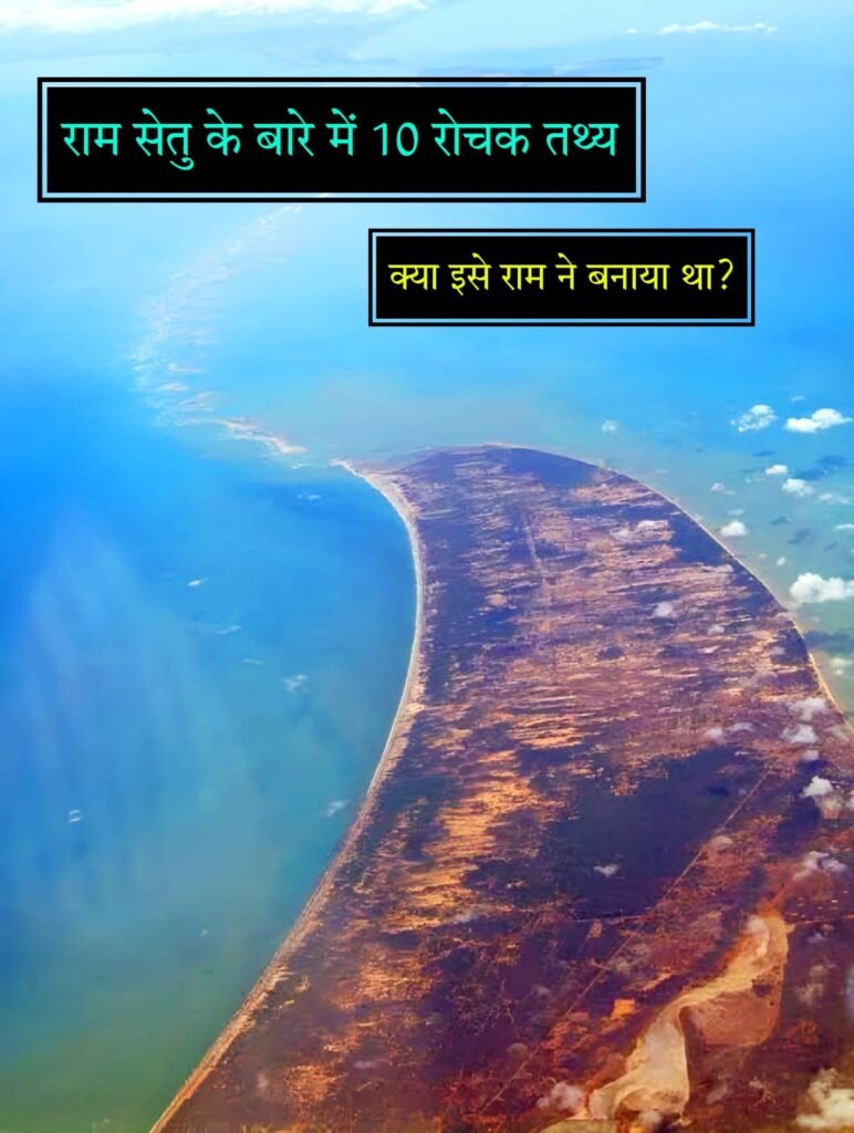
On a modern map the feature sits in the Gulf of Mannar / Palk Strait belt. Popular Indian writing places a roughly 48-kilometre-wide band of raised or barely submerged ground between Dhanushkodi on the Indian side and the Pamban–Mannar line toward north-west Sri Lanka. Other retellings call the rock line about 50 kilometres long. The water over much of it is described as river-shallow, with patches of land showing at low water. That geography is why ships going between India’s east and west coasts have long gone around Sri Lanka instead of cutting straight through.
Hindus who read the story as sacred history call the same ridge Ram Setu or, in the epic’s own naming, Nala Setu. Sri Lankan Muslims, according to the same popular account, were the first to call it Adam’s Bridge; Western Christian usage then settled on Adam’s Bridge, with the belief that Adam once crossed there. None of those names, by itself, tells you whether the ridge is a built monument, a coral-and-sand shoal, or both in different centuries. A name is a claim about meaning. The sandbars are a claim about the seabed.
The useful habit is to keep the vocabulary honest. “Ram Setu” in a temple talk means the bridge of the epic. “Adam’s Bridge” on a nautical chart means the shoal chain. “Nala Setu” is the name Valmiki’s text gives after the builder. When a headline treats those three as one proven object, the argument is already slanted. The rest of this piece walks through the epic layer, the satellite-and-geology layer, and the political layer without collapsing them.
People also point at Dhanushkodi, the village on the south-eastern edge of Rameswaram island, south-east of Pamban. The popular etymology says the approach to Lanka from that point traces a bow, hence dhanush (bow) and kodi (end or tip). Dhanushkodi is described as about 18 miles west of Talaimannar in Sri Lanka. That short gap is why the idea of a walkable crossing, at least in some past century, feels geographically thinkable even before anyone opens a scripture.
What the Valmiki Ramayana actually describes
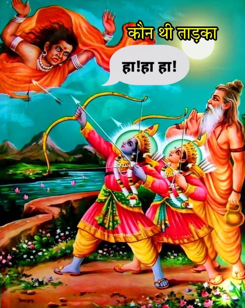
This is the faith-and-literature layer. It is not a lab report. In the Yuddha Kanda, Rama needs to take the vanara army from the Indian shore to Lanka to recover Sita from Ravana. After searching the coast, the text says he found a workable line seaward of Rameswaram. Construction is assigned to Nala and Nila, named as sons of Vishvakarma, with the vanara host as labour. Stones that float—popular retellings add that volcanic rock may stay up in water—are said to have been brought from elsewhere and set in the sea.
Valmiki’s poem, as cited in the traditional numbering used in these write-ups, gives scale and speed. The bridge is said to have been finished in about five days. Length is given as one hundred yojanas, width as ten. At the naming, Rama calls it Nala Setu because the method came from Nala. Gita Press Gorakhpur’s narrative retelling of the Valmiki Ramayana repeats that naming scene. The verse cluster commonly quoted for the finished work is Yuddha Kanda 6/22/76.
Another cluster, 6/22/62, is offered as evidence that the poet imagined organised technique, not a casual pile of rocks. Some vanaras, the lines say, hauled great hills to the shore with yantra—engines or mechanical devices. Others held a cord a hundred yojanas long so the line of the causeway would run straight. That is an epic description of survey-and-haul, not a modern engineering drawing. Treating it as a specification sheet is a modern habit. Treating it as part of the received story is what the tradition actually does.
The same popular chronology says Valmiki shaped the poem after Rama’s coronation, around 5075 BCE, pointing to Balakanda 1/4/1–2 for the setting of the composition, and that the text moved by shruti-smriti memory until a written form around 1000 BCE. Those dates are traditional claims inside a living religious culture. They are not carbon dates. They belong in the “what the tradition asserts” column, next to—not on top of—the satellite photographs.
Nala supervised the work; the vanaras built the setu with great effort. Rama named that crossing Nala Setu. — sense of Valmiki Ramayana 6/22/76 as used in popular Indian recensions
Read that way, the Ramayana answers a story question: how did the army cross? It does not, by itself, certify a particular sandbar on today’s Admiralty chart. The chart and the poem can be discussed in the same article. They should not be forced to wear the same label.
Other Hindu books that mention Nala Setu
The Hindi source-list of texts is longer than Valmiki alone, and that list is part of why the name survived outside one poem. The Mahabharata refers to Rama’s Nala Setu. Kalidasa, in sarga 13 of the Raghuvamsha, describes Rama’s return by the aerial path and has him show Sita the setu from the sky. In that later courtly poem the causeway is already a landmark that storms have begun to break. The setu is not only a war tool; it has become a remembered line on the water.
Puranic catalogues repeat the episode with their own verse blocks. The citations repeated in Indian popular articles are: Skanda Purana (third section, 1.2.1–114), Vishnu Purana (fourth section, 4.40–49), Agni Purana (chapters in the fifth-to-eleventh stretch of the relevant book), and Brahma Purana (138.1–40). Those passages do not add lab dates. They show that the memory of a Rama-built crossing was not confined to one forest manuscript. It was a stock scene across Sanskrit genres—epic, court kavya, and purana.
There is also a wider literary net that people use to argue the story is old in Indian public life, even if one disputes the 5075 BCE composition date. Kautilya’s Arthashastra (fourth century BCE) and the Buddhist Dasharatha Jataka (third century BCE) are named as early references to the Rama cycle. Those works do not, in the source we are following, supply a geological monograph on the Palk Strait. They show that Rama’s narrative was already in circulation when those books were compiled.
For a reader trying to separate layers, this section only proves cultural density. Many books remember a bridge. Many communities named a shoal after that memory. Density of memory is not the same thing as a quarry invoice. It is also not “just a cartoon.” It is a long literary trail, and it deserves to be quoted as literature and belief—not smuggled in as a substitute for sediment cores.
Satellite pictures and the geology of Adam’s Bridge
This is the map layer. American space photography of the India–Sri Lanka tip is real as photography. Popular Indian articles say NASA released worldwide pictures in 1993 of the raised belt between Dhanushkodi and Pamban, and that a Gemini-11 frame dated 14 December 1966 is the early space view. They add that about twenty-two years after that Gemini image, a platform they name ISS 1A recorded the submerged ground between Rameswaram and the Jaffna islands and thereby “confirmed” the American picture.
What those sentences reliably support is modest: cameras in orbit can see a pale, linear shoal across a shallow strait. What they do not support—because no quotation to that effect should be invented—is a NASA press line that “this is Rama’s bridge” or “this was built by an army.” A photograph shows tone and shape. Origin and sacred identity are interpretations people attach after the download.
A second scientific-sounding package travels with the pictures. It says rocks in the line are about seven thousand years old and the sand they rest on is about four thousand years old, and that the mismatch means people built the ridge. That package is a claim about dating, not a date you should treat as settled fact in an encyclopaedia voice. If rock is older than the bed it sits on, a geologist would want to know the lab, the sample, the method and the paper. The popular article does not provide those. So the honest English is: this age-gap argument is widely repeated; it is not, in this source, a published excavation report.
Natural readings of the same ridge also exist outside this article’s source and should be acknowledged as the other side of the geology conversation: a former land link, coral growth, tombolo and sandbar processes, storm rearrangement. You do not need to pick a winner to see the method. Satellite light is evidence of a feature. Age numbers without a cited lab are a rumour of evidence. Epic names are evidence of belief. Keep the three invoices separate and the feature gets less mystical and more interesting.
FACT BOX — what can be stated without inflating the claim
A chain of shoals lies between Dhanushkodi / Rameswaram (Tamil Nadu) and the Mannar–Talaimannar side of Sri Lanka. Common names for that chain: Ram Setu, Nala Setu, Adam’s Bridge. Popular measures in Indian articles: a belt about 48 km across, or a rock line about 50 km long; water often described as very shallow. Valmiki Ramayana (as cited): five-day build, 100 × 10 yojanas, name Nala Setu, verses 6/22/76 and 6/22/62. Also named in the Mahabharata, Kalidasa’s Raghuvamsha (sarga 13), Skanda, Vishnu, Agni and Brahma Puranas. Repeated historical note: walkable into the 15th century; a cyclone in 1480 CE said to have broken it; later sea-level rise left it mostly awash. Space photography of the strait exists (Gemini-11 era imagery is cited from 1966; wider circulation of images is dated to 1993 in popular Indian accounts). Sethusamudram canal plans turned the ridge into a political object; many Hindus protested any cutting of the setu; popular writing says the structure has already taken substantial damage. Akshay Kumar’s film Ram Setu brought the name back into mass entertainment. Ten circulating claims—and how to read each one
The Hindi source frames “ten interesting facts.” Here they are restated in English, with the genre tag each one deserves. That is how you use a list without laundering rumour into proof.
1993 NASA release / 1966 Gemini-11 frame / later ISS 1A confirmation. Map layer. Pictures of a shoal chain were circulated; the popular date-set is 14 December 1966 for Gemini-11 and 1993 for a public release that sparked Indian political argument. No NASA sentence identifying the ridge as Rama’s work is on record in this source. A U.S. programme titled Ancient Land Bridge, placed in these articles on the Science Channel in December 1917, with American archaeologists saying the Hindu story “could be true,” plus the 7,000-year rock / 4,000-year sand gap. Modern circulating claim. Report it as a claim that travels with the pictures. Do not upgrade it to a peer-reviewed field survey unless you have the paper in hand. Sri Lankan Muslims named it Adam’s Bridge first; Christians and Western writers followed, believing Adam crossed there. History-of-names layer. Parallel sacred naming is common on border landscapes. Walkable until the 15th century; cyclone of 1480 CE broke it; rising water drowned the rest. Historical note widely repeated for this strait. It explains why a “bridge” can be a memory and a hazard to keels at the same time. Valmiki: Nala and Nila, vanaras, floating stones, five days, 100 × 10 yojanas, name Nala Setu (6/22/76). Epic belief and text. Quote it as scripture. Dhanushkodi as the place of Rama’s bow-shot; Mahabharata also knows Nala Setu; Gita Press retelling of the naming. Place-lore plus epic. The village is real. The bow-shot is the story attached to the village. Yantra-hauled mountains and a hundred-yojana alignment cord (6/22/62). Epic technique-imagery. “High technology” is a modern gloss on an old verse. Kalidasa’s aerial view; storm damage; Skanda, Vishnu, Agni, Brahma Puranas. Literary afterlife of the same scene. Three days of search; site off Rameswaram; Dhanushkodi 18 miles west of Talaimannar. Mix of epic plot and local geography. Bow-shaped alignment; Mannar marine belt; the only India–Sri Lanka “land” edge where the sea is river-shallow and ground shows through. Place description plus etymology.
Read as a packet, the ten facts are a collage: two parts text, two parts place-names, two parts space photography, two parts uncited dating talk, two parts later history and politics. Collage is fine if you label the glue.
Sethusamudram, public anger and modern politics
This is the third layer, and it is the one that makes television panels loud. Under the Sethusamudram project, a shipping canal through the shallow strait was planned so vessels would not have to circumnavigate Sri Lanka. Popular Indian writing says work that would break or cut the setu produced anger among Hindus, that the quarrel then widened, and that the structure has already been damaged to a considerable extent. Those are political and activist claims about a development scheme. They are not a verse of Valmiki and not a satellite caption.
Why the anger makes sense inside the faith layer is obvious. If a community holds the ridge to be Rama’s work, a dredger is not a neutral machine. Why engineers wanted a cut is also obvious on a chart: shallow water wastes fuel and days. The collision is between a sacred landscape and a logistics landscape. Courts, parties and ministries have all stepped into that collision over the years. This article does not invent affidavits or verdicts that the source does not give. It only records the shape of the fight as the source records it: project, protest, alleged damage, unresolved heat.
The 1993 circulation of space pictures, the same source says, is when the landform became a national argument rather than a local shoal. That timing fits a familiar pattern. A remote-sensing image is easy to forward. A forwarded image plus a sacred name becomes a campaign. A campaign plus a canal tender becomes a file in a ministry. By the time a film titled Ram Setu arrives, the audience already thinks it is watching a documentary with song sequences. It is not. It is watching the three layers projected onto one screen.
If you want a clean public conversation, ask three separate questions in three separate sentences. Does the Ramayana describe a bridge? Yes. Does a shoal chain exist where people say it exists? Yes. Should a canal cut that chain? That is policy, ecology, faith and cost—and it cannot be settled by a Gemini photograph or a yojana count.
Dhanushkodi, Mannar and the bow-shaped path
Stand the story on the actual shore and it becomes less abstract. Dhanushkodi is a village on the southern edge of Rameswaram island, on Tamil Nadu’s east-facing coast, south-east of Pamban. Popular geography puts it about 18 miles west of Talaimannar. Between those two names runs the Mannar marine belt—the same belt tourists, fishermen and satellite agencies keep photographing because the water is pale and the sandbars stitch and unstitch with the tide.
The name Dhanushkodi is explained, in the source tradition, by shape: the line the vanaras took toward Lanka looked like a bow, and this was the tip of that bow. Whether you take that as folk etymology or as memory of an alignment, the physical point remains. This is described as the only stretch that behaves like a land boundary between India and Sri Lanka, with depth closer to a river than to open ocean and with ground appearing in places. That is why older notes say people once walked or waded toward Mannar Island, until storms and a higher sea made the walk a legend.
1480 CE is the year attached to the breaking cyclone. After that, the story goes, the setu was no longer a road. It became a hazard, a pilgrimage horizon, a fishing ground and, much later, a canal obstacle. Kalidasa’s sarga already imagines weather chewing the structure. The cyclone date is the historical-sounding version of the same idea. Again: a widely repeated date, not a ship’s log reproduced here.
If you only remember one geographic sentence, remember this. The argument is not about whether Rameswaram and Mannar face each other across shallow water. They do. The argument is about what that shallowness means—road of the Treta Yuga, remnant of a land bridge, coral and sand, or some sequence of those things. Meaning is the part humans add. The sandbars were there before the comment section.
Real or myth? Epic, geology and politics are not the same question
So, is Ram Setu Adam Bridge real or myth? Ask it as one question and you will get a slogan. Split it and you get a usable answer.
As epic and living faith: Ram Setu / Nala Setu is real inside the Ramayana world. Valmiki gives builders, measure, days, tools and a name. Kalidasa and several Puranas keep the scene in Sanskrit memory. Millions of people organise pilgrimage and protest around that memory. Calling that “only myth” as a sneer misses what myth-and-itihasa do in Indian culture: they carry identity, not just entertainment.
As a landform: Adam’s Bridge is real as a chain of shoals in a shallow strait. Cameras have recorded it. Mariners have avoided or used its shallows for centuries. A 15th-century walking surface and a 1480 cyclone are the historical notes attached to that landform in popular writing. That is enough to say the ridge is not an optical illusion.
As a man-made monument dated to Rama’s exact campaign: that is a modern claim, not a closed case. The age-gap story (older rock on younger sand) and the American-TV-archaeologist story are presented in circulating articles as scientific support. They are still circulating claims until someone puts a cited laboratory paper on the table. Inventing a NASA endorsement to close the gap would be dishonest. This article will not do that.
As politics: the Sethusamudram fight is real. Anger at cutting a sacred ridge is real. The charge that damage has already been done is a live public charge. Policy can respect faith, ecology and shipping at once only if it stops pretending that one satellite jpeg settles all three.
The oldest question in the Hindi source is still the human one, and it does not need a fake quotation. How did Valmiki, working with the tools of his age, describe a crossing that later generations could point to on a map of the same strait? Wonder is allowed. Wonder is not a substitute for a core sample. Hold both, and the topic stays adult.
FAQ
Is Ram Setu the same thing as Adam’s Bridge?
They name the same stretch of sea between Rameswaram–Dhanushkodi and the Mannar–Talaimannar side. “Ram Setu” / “Nala Setu” is the Hindu epic name. “Adam’s Bridge” is the name that, in the popular account, came from Sri Lankan Muslim usage and then from Western Christian usage.
Did NASA say the bridge was built by Rama?
No such NASA quotation appears in the source this article follows, and none should be invented. What is claimed is that NASA-circulated photographs (a Gemini-11 view dated in these articles to 14 December 1966, plus a 1993 public release) show the shoal belt. A picture of a ridge is not a verdict on who stacked it.
What does the Ramayana say about how the setu was built?
Nala and Nila direct the vanara army. Stones that float are set in the sea. A straight line is kept with a long cord. Hills are moved with yantra. The work is said to take five days. Rama names the finished crossing Nala Setu (verses cited as 6/22/62 and 6/22/76).
Why do people say the setu broke in 1480?
Popular historical notes say the crossing could be used into the 15th century, that a cyclone in 1480 CE broke it, and that a higher sea then left it mostly submerged. Treat that as the standard story attached to the strait, not as a newly excavated weather diary.
What is Sethusamudram doing in this debate?
It is the modern canal plan through the same shallows. When work was associated with cutting the setu, Hindu protest rose and the quarrel became national. Popular writing adds that the ridge has already been badly damaged. That is the political layer, not a verse and not a satellite caption.
Disclaimer
This English article restates names, dates, verse numbers and claims as they appear in the Hindi source feature on Ram Setu. Epic passages are belief and literature. Satellite images show a landform. Age figures, television-show citations and “humans built it” conclusions are circulating claims unless a primary scientific paper is produced. No NASA quotation identifying the ridge as Rama’s construction is used or invented here. Faith, geology and government projects are described as separate kinds of statement.